
The track's own water now sits at finer levels than a whole terrain step, and in the 3D view it is a see-through surface instead of a bare grid of lines — so you can finally see where the water meets the bank, and what lies under it.
Quarter steps need no patch: the game has always placed its water a quarter step at a time, and Traxx simply let you choose only whole steps. The see-through view is in the editor only.
The old Water Level page still tells you how to open the box and where to aim: not higher than your lowest road, unless you are dipping the road into the water on purpose. This page covers what is new. For water at other heights — a mountain pond above the main water — see Lakes.
Open Edit → Track Components (or the Track Components button on the toolbar) and look for Water Level. It still runs from 0 to 255, measured against the terrain, so water 100 sits level with terrain 100. What is new is that you can stop between the whole numbers.
Before this, a whole step — 2 ft — was the smallest move you had.
Note: if you have lakes on the track, Traxx will not let the main water rise into one. It refuses the change with the message The water level was not changed: it would reach Lake N. Delete or lower the lake first. Lower the lake, or delete it, and try again.
Switch to the OpenGL view: Use OpenGL Renderer on the General tab of View → Options, with Show Water ticked beside it (the F8 key does the same). The water is drawn as a see-through blue surface, so the bank cuts it off at the waterline and the ground shows through where it is shallow.
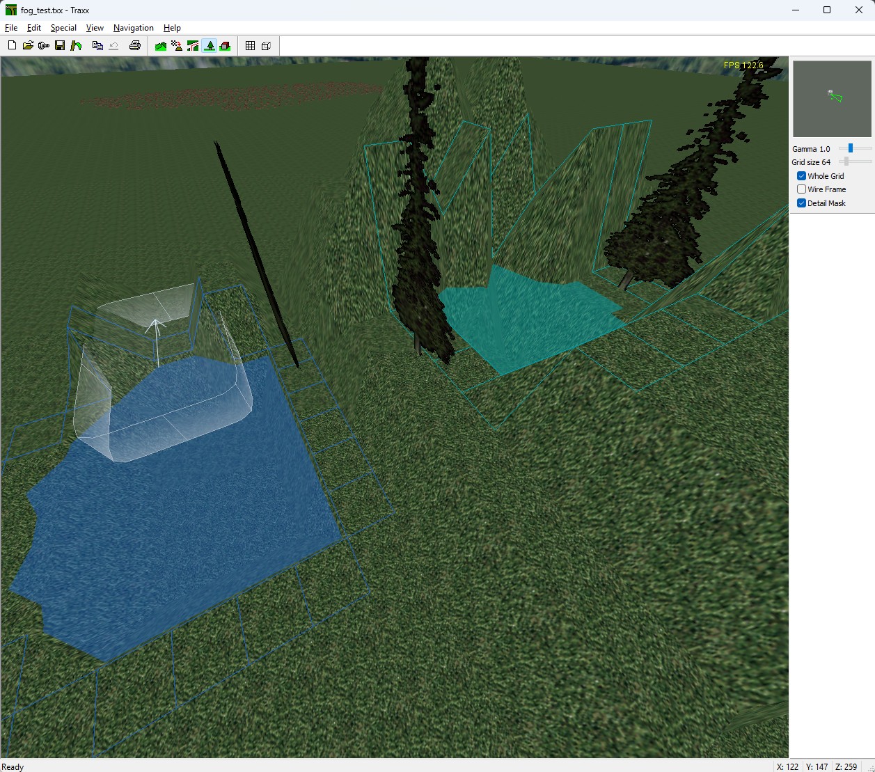
Tip: a shallow stretch with a model standing in it shows the effect best. With only the grid, shaping a river was guesswork.
Note: the software view still shows the old grid of lines. The see-through surface is an OpenGL view feature.
Choose View → Options, then the Advanced tab, and find Water opacity (0 = grid only). It takes a percentage from 0 to 100; its arrows move in steps of 5. It starts at 50, half see-through.
The same setting drives the lakes you build on the next page.
See also: Water Level, Components, Water Tracks.
| << Height Maps << | >> Lakes >> |
